Why the Route Matters
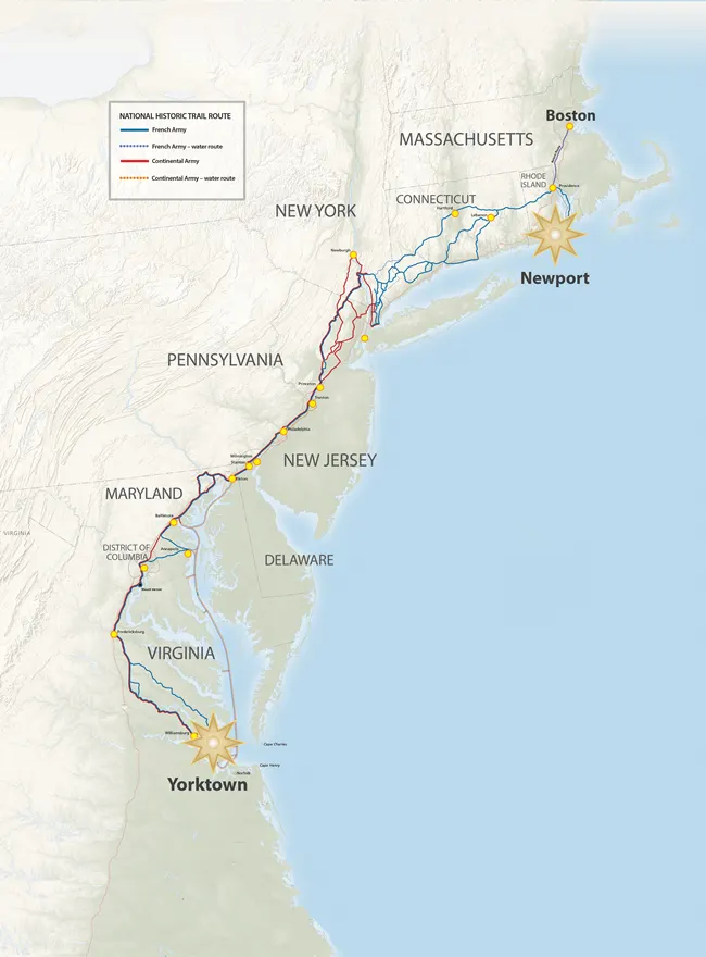
View interactive map from NPS.gov
From the early days of the War for Independence, France supported the American Patriots by supplying arms, ammunition, and military aid. On July 10, 1780, a French fleet arrived in Newport, Rhode Island, carrying about 450 officers and 5,300 infantry under the command of the comte de Rochambeau.
After wintering in Newport, the French army began its march on July 10, 1781, traveling through Providence and continuing toward New York, where they joined General George Washington’s Continental Army. Together, the allied forces marched south to Virginia. On September 28, 1781, they began the Siege of Yorktown, leading to the surrender of British General Cornwallis on October 17, 1781.
The French army later wintered near Williamsburg, Virginia, before beginning its return march north in July 1782. After leaving Providence, the troops passed through Pawtucket, the town of Attleborough, and North Attleborough, then continued toward Wrentham and eventually reached Boston’s Long Wharf before departing for the Caribbean.
The Washington-Rochambeau Route remembers this remarkable journey of cooperation, strategy, and alliance that helped secure American independence.
The Route Through Attleborough and North Attleborough
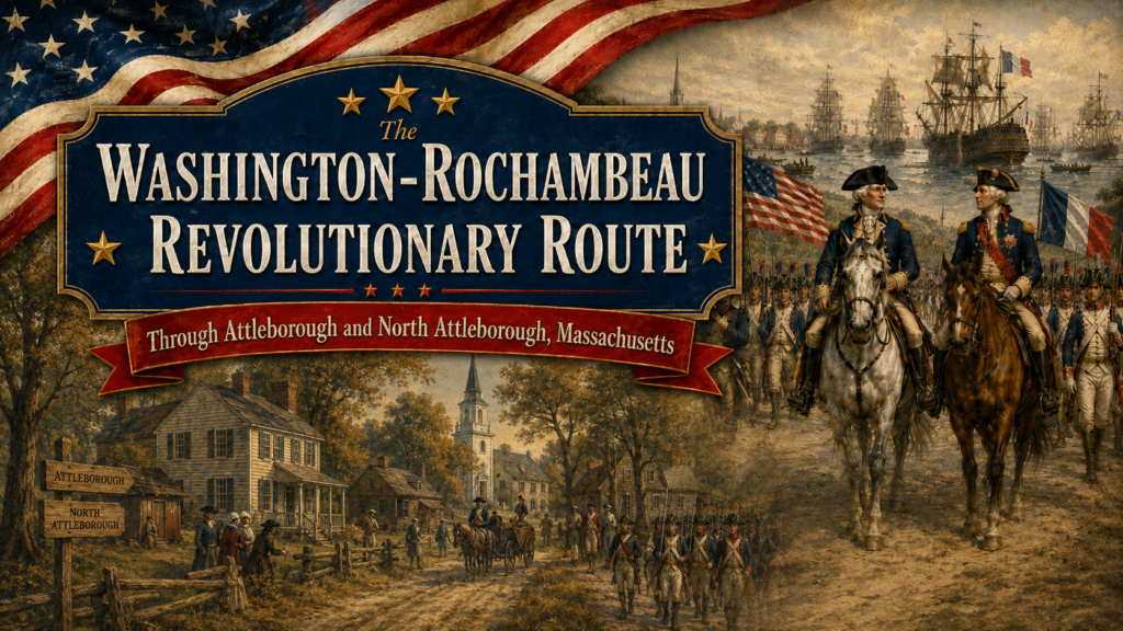
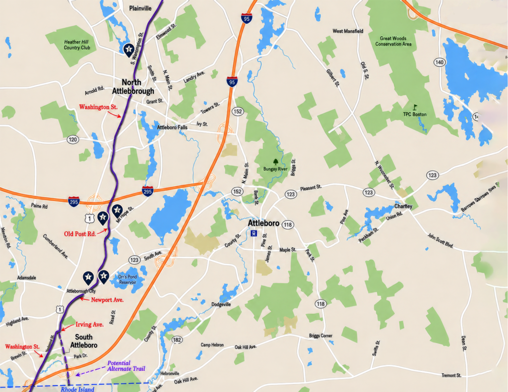
The Washington-Rochambeau Revolutionary Route passed through the Attleborough area as French forces returned north in 1782. This local section connects today’s roads with a nationally significant Revolutionary War story.
Historic Stops Along the Route
Thomas Tingley House
389 Newport Ave. • 1723
Early home tied to local militia tradition and Revolutionary War veterans Samuel and Benjamin Tingley.
Oldtown Church
675 Old Post Rd. • 1712
Attleborough’s first church and an important colonial meeting place.
Old Powder House
Mount Hope St. • 1768
Stored gunpowder and ammunition used for local defense in the Revolutionary era.
Newell Burying Ground
1502 West St. • Established 1715
Attleboro’s oldest cemetery, with graves of Revolutionary War veterans.
Woodcock Garrison / Tavern / Cemetery
Site linked to John Woodcock, an early settler, surveyor, farmer, and tavern keeper.
A Route of Remembrance, Cooperation, and Victory
The Washington-Rochambeau Revolutionary Route is more than a path across the map. It represents the alliance between France and the American colonies, the movement of thousands of soldiers, and the local communities that became part of the larger struggle for independence.
Trail Facts:
National Historic Trail
The Washington-Rochambeau Revolutionary Route is recognized as a National Historic Trail.
Established in 2009
The trail was officially established to preserve and interpret the allied march.
More Than 680 Miles Long
The full route extends across hundreds of miles from New England to Virginia.
Crosses 9 States and Washington, D.C.
The route follows the path of the allied march from Newport, Rhode Island, to Yorktown, Virginia.